|
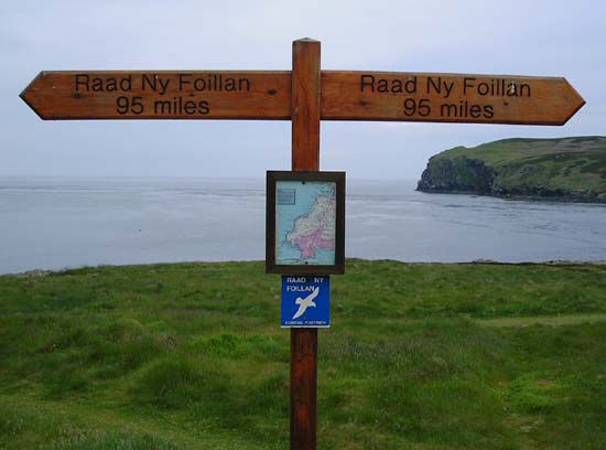
Raad Ny Foillan
I read about the
costal path around the Isle of Man whilst looking at some information
about The Munroes in Scotland. I had a surplus of holiday to use up and
decided to walk the Raad Ny Foillan (Manx for The Gull Road) in early
summer 2004. As it was a school holiday my mum came along too.
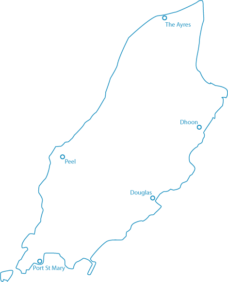
The path is officially 95 miles long although there are various estimates
around this figure. Scroll down to the bottom of this page for a basic map.
DAY ONE
We took the 2.5 hour seacat ferry crossing from Liverpool Dock to Douglas
with a number of bikers heading over for the first week of the TT festival.
When we arrived we headed north (or right) and began our loop of the island
in an anti-clockwise direction with our tent and camping gear on our backs. Apparently the more common direction to go is clockwise although I enjoyed this way as the more interesting parts - the hills - were in the latter part.
Our first days walking took us from Douglas through Laxey where we stopped for a drink in a pub in Old Laxey.
We met a really helpful female police officer who told us there was a campsite
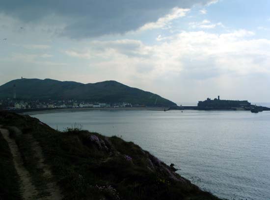
in Dhoon where we stayed that night after visiting the ancient King Orry's Grave. We had covered 13 miles.
DAY TWO
We set off fairly early and it seemed pretty hard going as it took much
longer than anticipated to get to Ramsey - our destination for breakfast.
The section getting towards Maughold Head meandered a lot but the views
from the top were superb. We had lunch outside a seafront cafe and then
walked a particularly challenging 5 mile section along a pebble beach,
it was sapping. We got to the Point of Ayr - the northernmost point of
the island.
We
then turned south-west and walked among the dunes for a further three
miles before camping wild in The Ayres. We had covered 19 miles. 32 miles
all together.

DAY
THREE
Another early start after an early night. We continued along the dunes
for several more miles. We joined a path that followed a disused railway
and caught up with two elderly ladies walkling their dogs. They invited
us in for tea and a biscuit and filled us in on the nuances of the TT
festival - when the sessions take place, good places to watch, who's good,
how many deaths they've had so far - and also told us about life on the
Isle of Man.
We stopped at a pub in Kirk Michael for lunch with a number of bikers
from various places. There was a group of Swiss chaps who were big into
that American leather and chrome approach
to motorcycling,
After lunch we continued along the old railway towards Peel.
Once in Peel we had a wander round and found a council run campsite on
one of the main roads back towards Douglas. We had covered 21 miles a
total of 53 miles from Douglas.
DAY
FOUR
An inspired decision. The campsite was good. The bags were really heavy.
Why not leave the stuff here and come back after a days walking? Thus
avoiding carring all the stuff, looking for a campsite, putting the tent
up etc.
The freedom of not having the bags felt much easier. We walked into the
town centre and up Patrick Hill - featured on the picture above - and
followed the coast south.
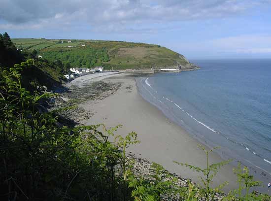
We stopped at a hotel in Dalby for a drink before heading down to the
stunning Niarbyl Bay, which we were told featured in the film Waking Ned
by lots of people.
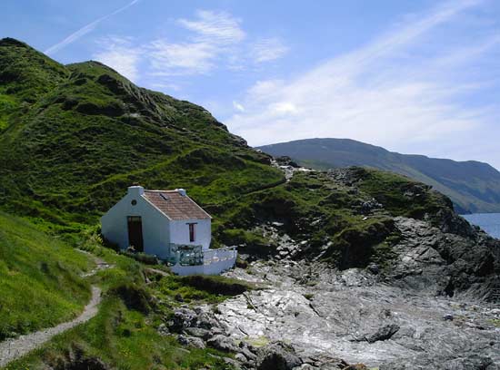
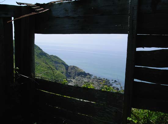
The
path was much less worn now and at times was very narrow with steep drops
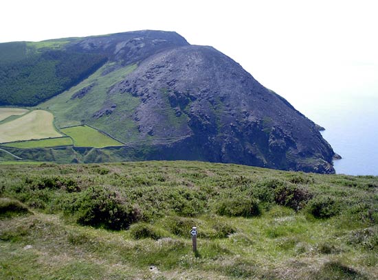
down to the cliffs and sea. We climbed the steep and tall Cronk ny Arry Laa and then went
back down to go back up Bradda Hill, which had fairly recently been the
victim of a fire and was charred and dusty.
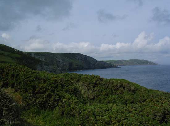
The
path then went round to Port Erin and seemed to take an age to get there.
We went past an interesting looking disused swimming pool/water park that
harked back to the era when the Isle of Man was a hot tourist destination.
We stopped at a cafe at the end of the beach and had a drink whilst a
group of young Asian people inflated a boat and seemingly rowed out to
sea. I'm not sure where they went but I'm sure the Coastguard picked them
up.
We picked up the path at the other end of the seafront where it rather
strangely resumed behind a marine research building. We walked around
to the peninsular taking in the Calf of Man island, some seals, The Chasms
and a number of dry-stone walls before we got to Port St Mary where we
got a cab back to Peel as we'd just missed the last bus.
We'd covered another 22 miles, bringing the total to 75 miles.
DAY
FIVE
We took a bus in the morning back to Port St Mary and picked up where
we had left off the previous evening. After walking for a few miles we
were caught out in some pouring rain for a little while, long enough for
my shoes to become wet through. We got to Castletown fairly quickly and
from what I recall it looked quite nice but as it was raining we didn't
amble around to get a feel for the place. We walked around past the main
island airport at Ronaldsway and on up the coast to Cronk ny Merriu fort.
The
weather had cheered up but we were starting to ache.
The path took an annoying detour inland where a landowner must have not
permitted the path to continue over their stretch of coastland. The detour
ended at Port Soderick another testiment to the island's past glories.
There are a number of concrete buildings and structures that were built
to attract tourists. It looked like the pub had only recently closed and
it seemed that there was a company offering cruises to and from Douglas
but it looked like they might have moved on too.
The path climbed up steps to the start of the Marine Drive, a name that
conjours up images from a bygone era.
Marine Drive itself was also shut to traffic as it can no longer take
the weight but it was being used by people for walking, running and cycling.
We followed the road until we were back in Douglas.
Another 20ish mile day completing the 95 mile loop!

©JB
2005 - Made in Hertford, UK
Think freely, eat well, bundle more
|